The drone is an increasingly accessible and used tool for the acquisition of aerial images.
In Europe, its use is more and more regulated. R&SD TECHNOLOGY has decided to train one of its employees in piloting with the aim of obtaining a class A flight license.
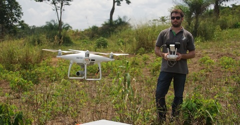
Bioengineer and GIS expert at R&SD Technology Vincent Bailly is completing his training as a class A drone pilot in Belgium.
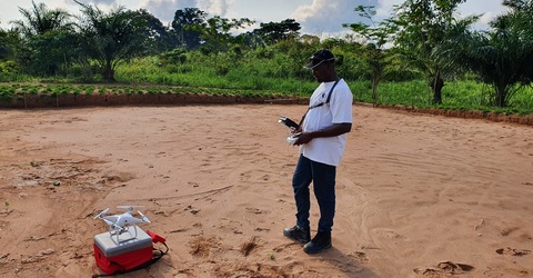
He has carried out mapping missions in the DRC where he uses his free time to train a colleague from R&SD, the expert Bioengineer Brice Djiofack in drone piloting.
In particular, these 2 experts carry out and will carry out mapping missions, aerial image acquisitions, satellite image analysis or even GIS training for students of the University of Kisangani. These activities are carried out within the framework of the FORETS project (Training, Research, Environment in TShopo), funded by the EU, implemented by the CIFOR (Centre of international forestry research) in partnership with R&SD.

Junior experts from R&SD Ltd Brice Djiofack (right side) and from R&SD Tech Vincent Bailly (left side) train to fly drones in DRC.

Drone image acquired to ensure scientific monitoring of plantations in the Goma region as part of the FORETS project activity. Location: Democratic Republic of Congo, Region of Goma.

Drone image acquired to ensure scientific monitoring of various planting techniques as part of the FORETS project activity. Location: Democratic Republic of Congo, Kisangani.


